
Results of the urban planning competition Plzeň - South City
Invited one-round urban competition for the development of an urban design proposal for the Plzeň – South City area
“The city of Plzeň declares the need for the creation of a new urbanistically valuable urban district with a diverse composition of functional use of the area. The Department of Urban Planning and Development of the City of Plzeň has therefore announced an urban competition for the development of a solution proposal for the Plzeň – South City area.”
Editorial
At first glance, the city’s intention seems logical and the competition’s assignment clear-cut. It is necessary to utilize the economically attractive area between the highway and the existing city and replace the not very inviting expanse of fields with a quality urban structure. However, upon closer examination, the topic is permeated with questions. Does Plzeň have the energy for such a large development? Is it not better to devote this energy to the inner city? Will a quality idea end up as a banal, if not unattractive fragment? Is the current intention of several developers the right impulse for extensive construction in the open landscape? Is it even possible to create South City as a fully-fledged “city”? From these perspectives, the city’s intention does not seem so logical and the competition assignment is not so clear-cut. Therefore, top-notch professionals were invited to answer these and other questions. I am pleased that the intention was successful. It is great that everyone more or less perceived the aforementioned questions as fundamental. It is great that most of them demonstrated much more than mere routine, however well executed. It is great that the competitors seriously examined the possibilities of this area within the whole city and region. It is great that they sought not only the content but also the form of the plan suitable for this project. Why? Because the resulting plan should create conditions for valuable use of the area at every stage of its development while preventing poor manifestations of this development. And standard forms of spatial planning documentation, with all due respect, cannot do that. The competition was excellently organized and its results are extraordinary in the context of the assignment, in the context of Plzeň, and in the context of the current search for an approach to spatial planning in the Czech Republic. The only cloud in such a clear sky I see is: so far, it has not been possible to share the aforementioned questions with the city leadership. Therefore, I wish the city of Plzeň not only a quality plan for “South City” but, mainly, the discovery of energy and a common language among experts, politicians, and residents to communicate about such significant topics.
Purpose of the Competition - to find the most suitable urban solution for the Plzeň – South City area and a suitable partner for the subsequent contract assignment (feasibility study of the area and feasibility study).
Area - is located in the southwestern edge of the city of Plzeň - within the administrative area of the municipal districts Plzeň 3, Plzeň 6, and partially in the administrative area of the municipality Útušice (cadastre areas Litice, Radobyčice, and Útušice).
- is bounded to the south by the D5 highway route, to the east by the Útušice–Radobyčice–Tyršův bridge (Bory) road, to the north by the southern boundary of recreational areas on Výsluní, and to the west by the edge of the existing built-up area of Litice and the road I/27 Plzeň–Klatovy (extension of Klatovská street).
- currently, the vast majority is used as agricultural land
- area: approx. 650 ha
Basic Facts about the Competition
- ten architectural teams were invited to participate in the competition
- two competing teams did not confirm their participation, one team did not submit a proposal
- the jury evaluated the work of seven teams
- the jury selected the urban design solution from RKAW s. r. o. doc. Ing. arch. Radek Kolařík as the best
- second place went to the proposal by Roman Koucký architectural office, s. r. o.
- third place was awarded to Ing. arch. Michal Bartošek and team
Dates
September 8, 2006 – inaugural meeting of the jury
September 20, 2006 – announcement of the competition
October 20, 2006 – jury meeting with competitors to answer questions
January 22, 2007 – submission of competition proposals
February 1 and 2, 2007 – jury evaluation meeting
March 9, 2007 – workshop in the parliamentary hall of the Plzeň city hall
April 26 to May 15, 2007 – exhibition of competition proposals in the gallery Bílý nároží in Plzeň
Competition Jury
Dependent jury members
Ing. arch. Irena Králová, Department of Urban Planning and Development of the City of Plzeň
RNDr. Milan Svoboda, Director of the Department of Urban Planning and Development of the City of Plzeň
Independent jury members
Ing. arch. Jan Jehlík, Chairman of the Jury, Jan Jehlík Architectural Office
prof. Ing. arch. Karel Maier, CSc., professor at the Faculty of Architecture of the Czech Technical University in Prague, Institute of Urbanism
Ing. arch. Zdeňka Táborská, Head of the Department of Urban Planning and Building Code of the City Hall of Teplice
Substitute jury members dependent
Ing. arch. Irena Langová, Department of Urban Planning and Development of the City of Plzeň
Ing. Irena Vostracká, Department of Urban Planning and Development of the City of Plzeň
Substitute independent jury members
Ing. Radim Gill, Director of DHV CR, spol. s r.o.
Ing. arch. Ludvík Grym, architectural office P.A.W. Grym & škrabal
JUDr. PhDr. Jiří Plos, Secretary of the Czech Chamber of Architects
Authorized representative of the organizer
Ing. Jiří Mařík, Department of Urban Planning and Development of the City of Plzeň
Reviewer of competition proposals
Hana Mendřecová, Department of Urban Planning and Development of the City of Plzeň
Competition Secretary
Ing. Eva Brejchová, Department of Urban Planning and Development of the City of Plzeň
Jury Statement on the Competition
The jury stated that exceptionally high-quality proposals were submitted to the competition, which share some common features. Most proposals currently recommend not building on the entire area and focusing on completing and transforming urban problem areas within the city's built-up territory. Most competitors in their proposals recommend that development be combined with the preservation or enhancement of the open landscape through recreational and economic functions. Most proposals do not consider intensive built-up areas along the highway. All contestants propose basic functions in the area including housing, logistics, amenities of supra-local importance, and recreation. The connection to the core city is primarily ensured by road I/27, which may pose certain risks in terms of traffic load with larger scale development.
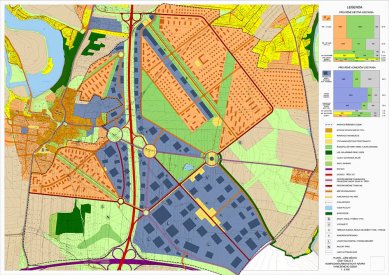
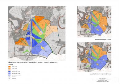
Jury Evaluation – The authors correctly identify the purpose of the competition as an analysis of the potentials of the area and a critical analysis of the client’s development vision. Considering the competition assignment, the authors offer a somewhat unconventional approach to the regulation of the area from a methodological and conceptual perspective. Using graphic symbols, they describe the intensity, functional and spatial arrangement of the area in an imaginative and user-friendly manner. They do not create new structures but establish certain basic parameters for decision-making regarding entry investments, their scale, and distribution. The connection of the built-up part of the area to the landscape is significant, albeit not entirely thoroughly developed, and is limited to elements of the ecological stability system. The value of the proposal is the urban radial parallel to road I/27, unfortunately with an unclear connection to the core city, and the utilization of its intersection with the connection Litice–Radobyčice as a "center" of the development zone. The linear model of development is elaborated in variants, significantly boosting the concept's flexibility over time. The area dedicated to production and logistics functions is oversized.
Jury Evaluation - a distinctly individual concept based on the belief that the long-term potential of the inner city of Plzeň within its existing boundaries is underutilized. Thus, the authors propose a thorough delimitation of the current urban structure of the city. They state that the area in question is excessive for comprehensive building, which threatens to drain the “energy” of the city of Plzeň. The authors therefore propose to complete the internal structures of the city according to its potential and create an open landscape within the area in question with individual distinctly defined entities (“clusters”) of multilayered intense and highly concentrated construction. This understanding is considered by the authors to be more ecological and economical. The placement of the “clusters” attempts to respect the morphology of the landscape and appropriately complement the existing settlement structures. Individual “clusters” are multifunctional except for “Uni/21,” and do not communicate together. The intellectually strong concept of “clusters” is called into question by an unclear idea of future realization.
Jury Evaluation – one of the coherent proposals for the area, built on the concept of tension between the landscape and urbanized elements, arranged along the filament of the main communication in the form of smaller rural-type settlements close to the existing municipalities Radobyčice and Litice, with a central core of urbanized units. The spatial arrangement is based on the morphology of the landscape, which it grants a very significant position in organizing the area. This concept is a self-contained entity without significant compositional ties to the city of Plzeň. The acceptable scale of individual residential units would likely be attractive to residents. Their arrangement around central public spaces (squares) is favorable, but the location of these spaces is not supported by the intersection of the communication system. The variant connection of the area by tram line paradoxically ends at the edge of the built-up area, and thus requires a transfer to reach the residential parts. The quality of the outcome is dependent on the degree of fulfillment of the proposed concept.
Jury Evaluation – the authors successfully and very aptly identify the urban and landscape deficits of the area and reasonably deduce that the urbanization effort should be focused on completing the internal area of the city of Plzeň. However, from this analysis, they do not consistently derive the manner of resolution. The chosen grid is a formal aesthetic construct, derived without credible justification. Its orientation (north-south, east-west) contradicts the previous development of settlement and the morphology of the landscape. The landscape solution concept is very superficial and essentially relies on the ecological stability system, isolating greenery, and general references to valuable landscape greenery. Similarly, the transportation is resolved superficially, not aiding in defining the shape of either the landscape or the urbanized space.
Jury Evaluation – the authors of the proposal accurately and aptly characterize the state of the area, both from urban and landscape perspectives, and do not recommend building on the area. However, the specific proposed solution does not respect these starting premises, creating extensive surface construction described in a very traditional way, especially by basic functional delineation of plots, traditional notions of transportation, technical infrastructure, and landscape. The erroneous basic urban concept of compositional axes north-south is not respected by the authors themselves; the specific proposal does not correspond to the character and division of the area, its morphology, and the previous development of related settlement. This handicap is not addressed even by the conceptual proposal of phases and variants. The transportation and landscape solutions are schematic, and the term landscape is fundamentally equated with the ecological stability system.
• addressing the pressure for commercial utilization of the surroundings of the highway, which is an opportunity that Plzeň does not want to miss, • addressing the solidification of the existing settlements in the area (Radobyčice, Litice) whose edges are unclear and imprecise, • addressing the problematic area of the “rocky” gardening colony beyond the northern boundary of the area, • establishing a land reserve for the area itself and its significant links. The second phase is based on the fact that today the needs and dynamism of development in the area are not clearly known. The aim of the proposal is to demonstrate possible management tools for the area, which must be deeply elaborated. The tools fall into three categories: regulations, incentives, and the delineation of public benefit buildings. Assuming both of the above-mentioned fundamental phases are realized, the proposal addresses the area as follows: Phase I – in the space between the highway and the road connecting Litice and Radobyčice, a zone primarily designated for logistics, possibly commerce, is placed. Litice and Radobyčice are naturally completed, leading to a logical culmination of the borders of both settlements. The regulation of construction in the chalet area Výsluní at the northern edge of the area is managed through a special construction ban. Phase II – to the north of the road connecting Litice and Radobyčice, a strip of land is defined, lying between the existing communication I/27 and the newly proposed tram line. This space is suitable for commercial use, technopark, exhibition grounds, conference center, aquapark, etc. East of the north-south branch of the tram is the area defined for education, sports, and leisure. Along the reconstructed and partially relocated road from Litice to Radobyčice is a new, predominantly residential construction localized. In terms of transportation solution, a significant new element is the expansion of the intersection of communication I/27 with the highway D5 to include a connection to the commercial zone. The main idea of the proposed urban public transport is the gradual creation of a circular tram route, from which the South City area would also be connected.
Jury Evaluation – the authors of this proposal belong to the most rigorous advocates of the opinion on the unsuitability of building the area in question. Although they propose a certain arrangement of the area in variants and phases, they continuously emphasize that the city’s potential (very extensive and underutilized) is threatened by new construction. For possible construction, they suggest rather rules for decision-making, following steps in a specific (predefined) framework, where each individual decision must be "rectified," establishing and securing structures so that this "rectification" would prevent unstructured, organic development lacking order. In overall solutions in advanced phases of development of the construction, they do not respect their original premises, which is particularly evident from the proposal for the development of Radobyčice and the somewhat complicated shaping of the landscape. The proposal considers a special construction ban for the area of Výsluní, which should allow for its future transformation. A significant element of the proposal is the integration of the addressed space into the tram systems, but the development potential of this infrastructural investment is not sufficiently utilized for the development of residential construction.
Jury Evaluation – similarly to other competitors, this team states in its proposal that building in this area is purposeless. It recommends not developing the area and focusing efforts on completing the internal areas of the city of Plzeň. However, since the competition requires an answer regarding the use of this area, and due to its exceptionally good transport accessibility, the authors propose a relatively coherent concept with a more or less closed construction structure (somewhat reminiscent of the concept of Zlín). The central park, as the basic linear oriented space ("Ringstrasse"?), which induces the feeling of a coherent urban structure, however, does not connect completely organically either to the city of Plzeň or to the neighboring settlements of Radobyčice and Litice. The landscape solution is schematic without a significant relationship to the morphology or the existing arrangement.
“The city of Plzeň declares the need for the creation of a new urbanistically valuable urban district with a diverse composition of functional use of the area. The Department of Urban Planning and Development of the City of Plzeň has therefore announced an urban competition for the development of a solution proposal for the Plzeň – South City area.”
RNDr. Milan Svoboda, Director of the Department of Urban Planning and Development of the City of Plzeň
Editorial
At first glance, the city’s intention seems logical and the competition’s assignment clear-cut. It is necessary to utilize the economically attractive area between the highway and the existing city and replace the not very inviting expanse of fields with a quality urban structure. However, upon closer examination, the topic is permeated with questions. Does Plzeň have the energy for such a large development? Is it not better to devote this energy to the inner city? Will a quality idea end up as a banal, if not unattractive fragment? Is the current intention of several developers the right impulse for extensive construction in the open landscape? Is it even possible to create South City as a fully-fledged “city”? From these perspectives, the city’s intention does not seem so logical and the competition assignment is not so clear-cut. Therefore, top-notch professionals were invited to answer these and other questions. I am pleased that the intention was successful. It is great that everyone more or less perceived the aforementioned questions as fundamental. It is great that most of them demonstrated much more than mere routine, however well executed. It is great that the competitors seriously examined the possibilities of this area within the whole city and region. It is great that they sought not only the content but also the form of the plan suitable for this project. Why? Because the resulting plan should create conditions for valuable use of the area at every stage of its development while preventing poor manifestations of this development. And standard forms of spatial planning documentation, with all due respect, cannot do that. The competition was excellently organized and its results are extraordinary in the context of the assignment, in the context of Plzeň, and in the context of the current search for an approach to spatial planning in the Czech Republic. The only cloud in such a clear sky I see is: so far, it has not been possible to share the aforementioned questions with the city leadership. Therefore, I wish the city of Plzeň not only a quality plan for “South City” but, mainly, the discovery of energy and a common language among experts, politicians, and residents to communicate about such significant topics.
Ing. arch. Jan Jehlík, Chairman of the Jury
Purpose of the Competition - to find the most suitable urban solution for the Plzeň – South City area and a suitable partner for the subsequent contract assignment (feasibility study of the area and feasibility study).
Area - is located in the southwestern edge of the city of Plzeň - within the administrative area of the municipal districts Plzeň 3, Plzeň 6, and partially in the administrative area of the municipality Útušice (cadastre areas Litice, Radobyčice, and Útušice).
- is bounded to the south by the D5 highway route, to the east by the Útušice–Radobyčice–Tyršův bridge (Bory) road, to the north by the southern boundary of recreational areas on Výsluní, and to the west by the edge of the existing built-up area of Litice and the road I/27 Plzeň–Klatovy (extension of Klatovská street).
- currently, the vast majority is used as agricultural land
- area: approx. 650 ha
Basic Facts about the Competition
- ten architectural teams were invited to participate in the competition
- two competing teams did not confirm their participation, one team did not submit a proposal
- the jury evaluated the work of seven teams
- the jury selected the urban design solution from RKAW s. r. o. doc. Ing. arch. Radek Kolařík as the best
- second place went to the proposal by Roman Koucký architectural office, s. r. o.
- third place was awarded to Ing. arch. Michal Bartošek and team
Dates
September 8, 2006 – inaugural meeting of the jury
September 20, 2006 – announcement of the competition
October 20, 2006 – jury meeting with competitors to answer questions
January 22, 2007 – submission of competition proposals
February 1 and 2, 2007 – jury evaluation meeting
March 9, 2007 – workshop in the parliamentary hall of the Plzeň city hall
April 26 to May 15, 2007 – exhibition of competition proposals in the gallery Bílý nároží in Plzeň
Competition Jury
Dependent jury members
Ing. arch. Irena Králová, Department of Urban Planning and Development of the City of Plzeň
RNDr. Milan Svoboda, Director of the Department of Urban Planning and Development of the City of Plzeň
Independent jury members
Ing. arch. Jan Jehlík, Chairman of the Jury, Jan Jehlík Architectural Office
prof. Ing. arch. Karel Maier, CSc., professor at the Faculty of Architecture of the Czech Technical University in Prague, Institute of Urbanism
Ing. arch. Zdeňka Táborská, Head of the Department of Urban Planning and Building Code of the City Hall of Teplice
Substitute jury members dependent
Ing. arch. Irena Langová, Department of Urban Planning and Development of the City of Plzeň
Ing. Irena Vostracká, Department of Urban Planning and Development of the City of Plzeň
Substitute independent jury members
Ing. Radim Gill, Director of DHV CR, spol. s r.o.
Ing. arch. Ludvík Grym, architectural office P.A.W. Grym & škrabal
JUDr. PhDr. Jiří Plos, Secretary of the Czech Chamber of Architects
Authorized representative of the organizer
Ing. Jiří Mařík, Department of Urban Planning and Development of the City of Plzeň
Reviewer of competition proposals
Hana Mendřecová, Department of Urban Planning and Development of the City of Plzeň
Competition Secretary
Ing. Eva Brejchová, Department of Urban Planning and Development of the City of Plzeň
Jury Statement on the Competition
The jury stated that exceptionally high-quality proposals were submitted to the competition, which share some common features. Most proposals currently recommend not building on the entire area and focusing on completing and transforming urban problem areas within the city's built-up territory. Most competitors in their proposals recommend that development be combined with the preservation or enhancement of the open landscape through recreational and economic functions. Most proposals do not consider intensive built-up areas along the highway. All contestants propose basic functions in the area including housing, logistics, amenities of supra-local importance, and recreation. The connection to the core city is primarily ensured by road I/27, which may pose certain risks in terms of traffic load with larger scale development.
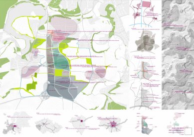
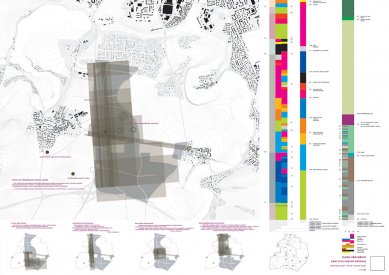
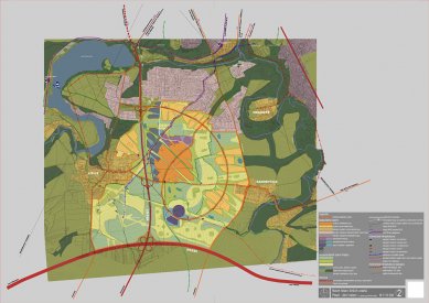
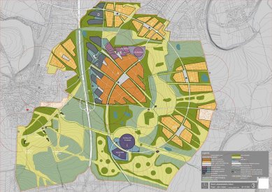
1st place – Proposal No. 7 – RKAW s.r.o., doc. Ing. arch. Radek Kolařík
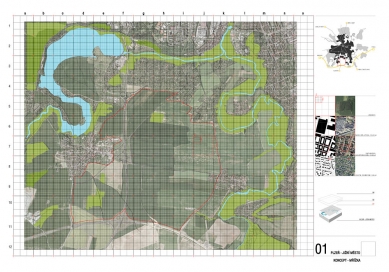
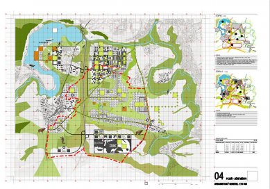
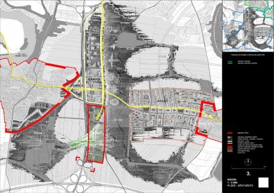
From the author’s report – The purpose of the competition proposal is to create a comprehensible guide for the development of the area so that the presented opinion serves as a good basis for the development of an effective tool that would define and possibly change the urban plan. Within the defined area, plots for building are designated. Three principles employing an identical strategy are applied in their localization: compatibility of construction (urbanization) with the landscape and needs. The buildable, homogeneous area is situated along communication I/27 in a band that widens in the southern part. Practically at the center of this area runs a newly proposed radial road, which forms a significant compositional element. On the eastern side, the buildable area is defined by a system of ecological stability. The entire area of the newly designed urban district is divided into five sectors, whose development is conditional on building infrastructure along the main communication route using existing access points to the area. The sectors represent the basic functional and spatial division of the area designated for building. Their boundaries define the main public spaces within the area. The size of the sectors varies depending on the prevailing functional use. The sectors are further divided into zones, which are standalone entities. Description of individual sectors: Sector 01 SUPPLEMENTARY FUNCTIONS - only a small part encroaches into the area in question; it is also the smallest, identical to the zone; its development is practically independent of other sectors; services serving the nearest vicinity. Sector 02 RESIDENTIAL DISTRICT WITH COMMUNITY FACILITIES - a transitional element between the existing structure transforming gardening colonies into a residential district; construction of family houses in one zone transitions into open construction of apartment buildings with community facilities. Sector 03 MIXED AREA - closed construction on the side of the feeder transitions into an alternation of closed and open construction along the main street of the new urban district, vibrant ground floor, opportunities for work, housing, culture, short-term recreation. Sector 04 PARK – RECREATIONAL AREA, EDUCATION, EXHIBITION, AND CONFERENCE - generously designed public space at the intersection of the area, loosely defined by buildings of regional significance; individual zones are prepared for the construction of solitary complexes in the context of the central urban park. Sector 05 LOGISTICS, PRODUCTION - the division of the area by public non-buildable plots allows for the realization of large buildings; development of the area begins in the central part; in case of a change in demand, the function can be adapted (gradually in the western part, subsequently in the eastern). For the transportation connection of the area, the existing communication network is used; a significant new element is a newly inserted interchange connecting Sector D5 with the communication I/27. Public transport will be provided by bus lines.Jury Evaluation – The authors correctly identify the purpose of the competition as an analysis of the potentials of the area and a critical analysis of the client’s development vision. Considering the competition assignment, the authors offer a somewhat unconventional approach to the regulation of the area from a methodological and conceptual perspective. Using graphic symbols, they describe the intensity, functional and spatial arrangement of the area in an imaginative and user-friendly manner. They do not create new structures but establish certain basic parameters for decision-making regarding entry investments, their scale, and distribution. The connection of the built-up part of the area to the landscape is significant, albeit not entirely thoroughly developed, and is limited to elements of the ecological stability system. The value of the proposal is the urban radial parallel to road I/27, unfortunately with an unclear connection to the core city, and the utilization of its intersection with the connection Litice–Radobyčice as a "center" of the development zone. The linear model of development is elaborated in variants, significantly boosting the concept's flexibility over time. The area dedicated to production and logistics functions is oversized.
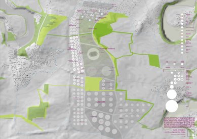
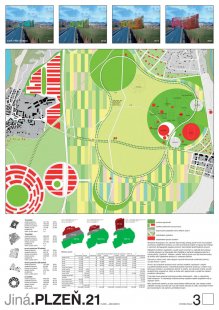
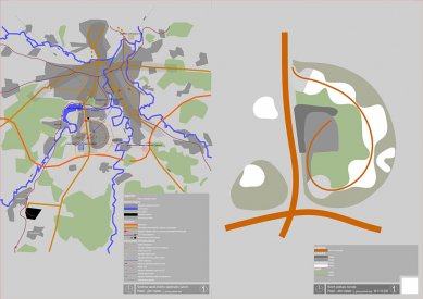
2nd place – Proposal No. 6 – Roman Koucký architectural office, s.r.o.
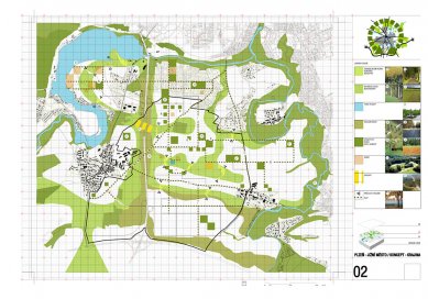
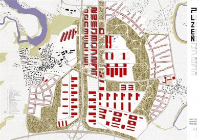
From the author’s report – The utilization of the area is proposed through new intense “clusters” that additively stack together and create a network of new relationships in both landscape and society. Clusters, which are interconnected by the latest technologies, are nevertheless living organisms amidst a cultural landscape. A cluster as a standalone flexible unit offers expanded possibilities and a global “metapotential,” which should be almost limitless. A new dominant feature of the region is proposed, not just the city. A dominance in the landscape that has a relationship to a regionally significant road (D5 = E50) and to the local horizon. A global point is proposed – A PLACE. The basic characteristic of the entire proposal is openness. The solution can be summarized in this thesis: within the park-styled area, there are paths of varying hierarchies. These paths connect a finite number of more or less thematically focused clusters. The shapes and methods of cluster construction are only indicated; their final form will be brought by specific projects. The whole composition is complemented at the northern edge of the area by individual constructions, which connect to the existing built structure. Characteristics of individual clusters: Cluster log/11 - Warehouse area and potential small-scale production directly connected to I/27 with a prominent advertising façade (in barcode shape) facing this highway feeder. Cluster exp/14 - The exhibition area “EX Plzeň 2014” is directly connected to the city and the highway and has the possibility for further growth if needed. It is ideally connected to the universal Cluster 21. Cluster fit/20 - A sports complex in the midst of an expansive landscape park, which, due to its location and connection to both the highway and the city, meets potential requirements for individual sports venues for the Olympic Games. Cluster uni/21 - A universal “urban” structure that can be filled with virtually any function within the proposed buildings. The accommodation and conference portions may collaborate perfectly with Clusters 14 and 20. The basic criterion for the successful use of the area must be the shortest communications and efficient connection to engineering networks. The smallest built-up area and zero “residual” areas are important. Therefore, all “green” activities must be concentrated into the broader surroundings of the built structure in cohesive blocks.Jury Evaluation - a distinctly individual concept based on the belief that the long-term potential of the inner city of Plzeň within its existing boundaries is underutilized. Thus, the authors propose a thorough delimitation of the current urban structure of the city. They state that the area in question is excessive for comprehensive building, which threatens to drain the “energy” of the city of Plzeň. The authors therefore propose to complete the internal structures of the city according to its potential and create an open landscape within the area in question with individual distinctly defined entities (“clusters”) of multilayered intense and highly concentrated construction. This understanding is considered by the authors to be more ecological and economical. The placement of the “clusters” attempts to respect the morphology of the landscape and appropriately complement the existing settlement structures. Individual “clusters” are multifunctional except for “Uni/21,” and do not communicate together. The intellectually strong concept of “clusters” is called into question by an unclear idea of future realization.
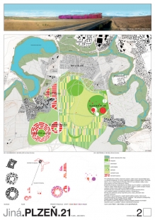
3rd place – Proposal No. 5 – Ing. arch. Michal Bartošek
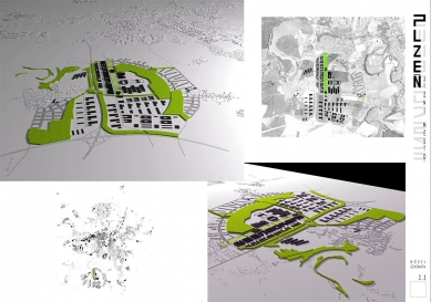
From the author’s report – In the proposal, the character of the area in question is understood as satellite, requiring an internally autonomous composition made up of components arising from city-wide needs analysis. These mainly include housing, higher education, science and research, social services, sports, recreation, leisure activities, exhibitions, administration, and light manufacturing. Activities located in the area should not succumb to commercial pressures arising from the potential of the highway system. The area’s solution should be urban-focused, not a service area for the highway. The main urban principles of the proposal are as follows: • intensive utilization of buildable areas in favor of cultural landscape, • the development curve creates an autonomous compositional axis uniting the basic typological types, • basic typological types emerge as self-sufficient settlements with clear central spaces, • the university campus integrates into the urban structure, • concentration of regional sports facilities ensures a continuous operational regime, • predominantly commercially utilized areas create a noise barrier and serve as a showcase along the approach to Plzeň, • the basic service communication meets the comprehensive requirements of operational integration of the entire complex and allows significant independence of induced transport towards road I/27 without negative impacts on the existing service network. The proposal defines individual types of buildable areas and describes their location and basic characteristics. In the relationship between human settlement and landscape, the proposal accepts the principle that the landscape with its natural elements must permeate the built-up areas and permanently separate individual communities. In terms of traffic solutions, the proposal respects the existing communication framework, with a new incoming service communication introduced that connects the newly proposed complexes. Public transport is proposed on a bus basis, with alternative possibilities for extending tram lines, either only to the monitored South City complex or possibly all the way to the area of the football stadium and sports in the southern portion of the area.Jury Evaluation – one of the coherent proposals for the area, built on the concept of tension between the landscape and urbanized elements, arranged along the filament of the main communication in the form of smaller rural-type settlements close to the existing municipalities Radobyčice and Litice, with a central core of urbanized units. The spatial arrangement is based on the morphology of the landscape, which it grants a very significant position in organizing the area. This concept is a self-contained entity without significant compositional ties to the city of Plzeň. The acceptable scale of individual residential units would likely be attractive to residents. Their arrangement around central public spaces (squares) is favorable, but the location of these spaces is not supported by the intersection of the communication system. The variant connection of the area by tram line paradoxically ends at the edge of the built-up area, and thus requires a transfer to reach the residential parts. The quality of the outcome is dependent on the degree of fulfillment of the proposed concept.
Proposal No. 1 - A69 – architects s.r.o.
From the author’s report – The proposal does not present an end goal but a path of development. It does not offer a clear vision of an end goal but provides a strategy for this path. It is open and prepared to grow. Its aim is to strengthen authentic points (existing settlements and infrastructure in the area). The proposed solution is based on partial proposals, among which the following are important: • defining existing settlements as foci of development, • restoring links interrupted by feeder I/27, • conversion of the character of agricultural lands into landscapes with recreational, landscape-making, and ecological characteristics, • conversion of gardening colonies into regulated urban structures. The basic proposed spatial organizational element is a grid, which acts as the unifying tool of the proposal. The grid is derived from the analysis of existing scales in the urban area of Plzeň. Individual grid fields are defined by the prevailing function (greenery, residential housing, logistics) and a usage rate is designated for them. The proposal considers the creation of landscape in the given area to be vital for its further harmonious development. The leading principle of the solution is the connection of the green corridors of the Radbuza and Úhlava rivers and the expansion of the existing natural park. A part of this principle is an ecobridge over the feeder from the highway, which significantly contributes to the permeability of the area between the two rivers. The area in question is connected from communication I/27 via two grade-separated interchanges. The northern connection point utilizes the existing interchange but complements and adjusts it. The southern connection point is located in a new position between the highway and the existing interchange, from which only the grade-separated intersection is used, ramps are eliminated. Public transport is designed as a network of bus lines in the context of the city-wide public transport system. The possibility of extending the existing tram line into the area is also considered conceptually.Jury Evaluation – the authors successfully and very aptly identify the urban and landscape deficits of the area and reasonably deduce that the urbanization effort should be focused on completing the internal area of the city of Plzeň. However, from this analysis, they do not consistently derive the manner of resolution. The chosen grid is a formal aesthetic construct, derived without credible justification. Its orientation (north-south, east-west) contradicts the previous development of settlement and the morphology of the landscape. The landscape solution concept is very superficial and essentially relies on the ecological stability system, isolating greenery, and general references to valuable landscape greenery. Similarly, the transportation is resolved superficially, not aiding in defining the shape of either the landscape or the urbanized space.
Proposal No. 2 – S.P.S., architects, s.r.o.
From the author’s report – The proposal is based on the existing structure of the majority of settlements around Plzeň, which has a centric character, and the very structure of the city formed from self-sufficient historical districts. In this context, the area of South City is evaluated as too large for a single settlement unit. Therefore, three mutually complementary entities are proposed, together forming a higher whole, Plzeň – South City. These entities cooperate both among themselves and with other parts of Plzeň, each in its own way. These are the three entities: Litice – the proposal respects the separation of the Litice area from the rest of the area created by the existing feeder; further development on the plots around Litice as the development of Litice itself; Northeastern entity – this entity located east of communication I/27 is proposed as an extensive, predominantly residential unit, whose development and compositional axis points southeast approximately to the center of the entire eastern part of the area. Southeastern entity – this entity also located east of communication I/27 is predominantly proposed for commercial use; its developmental axis runs parallel to the developmental axis of the residential unit. Besides the development axes of individual parts, there is a collision of residential and commercial functions along the imaginary (compositional) north-south axis, and here is the center of the new higher unit. The proposal thus addresses the issue of compatibility of typologically very different objects, residential and commercial, from their complete separation in the north and south of the area to their intersection in this center. The second compositional axis of the Plzeň – South City unit runs east-west, connecting the historical settlements of Litice and Radobyčice. We might also call it the green axis of the city. The proposal strictly adheres to the existing connection to communication I/27. To improve accessibility to the area from the highway, a new one-way exit from route I/27 is proposed, providing a short link to the core of the commercial zone in the southern part of the area.Jury Evaluation – the authors of the proposal accurately and aptly characterize the state of the area, both from urban and landscape perspectives, and do not recommend building on the area. However, the specific proposed solution does not respect these starting premises, creating extensive surface construction described in a very traditional way, especially by basic functional delineation of plots, traditional notions of transportation, technical infrastructure, and landscape. The erroneous basic urban concept of compositional axes north-south is not respected by the authors themselves; the specific proposal does not correspond to the character and division of the area, its morphology, and the previous development of related settlement. This handicap is not addressed even by the conceptual proposal of phases and variants. The transportation and landscape solutions are schematic, and the term landscape is fundamentally equated with the ecological stability system.
Proposal No. 3 – Masák and partner
From the author’s report – the presented proposal is more than an urban study; it is a proposal for the management of the area. More than a regulation, it outlines possibilities for progress. More than accepting common understandings of established values, it reevaluates basic relationships in the area. What is characteristic about this proposal is the emphatic division into two time phases, for the near time frame and the distant future. The first, temporally closer phase, must address the pressures that are only arising today, summarized in the following points:• addressing the pressure for commercial utilization of the surroundings of the highway, which is an opportunity that Plzeň does not want to miss, • addressing the solidification of the existing settlements in the area (Radobyčice, Litice) whose edges are unclear and imprecise, • addressing the problematic area of the “rocky” gardening colony beyond the northern boundary of the area, • establishing a land reserve for the area itself and its significant links. The second phase is based on the fact that today the needs and dynamism of development in the area are not clearly known. The aim of the proposal is to demonstrate possible management tools for the area, which must be deeply elaborated. The tools fall into three categories: regulations, incentives, and the delineation of public benefit buildings. Assuming both of the above-mentioned fundamental phases are realized, the proposal addresses the area as follows: Phase I – in the space between the highway and the road connecting Litice and Radobyčice, a zone primarily designated for logistics, possibly commerce, is placed. Litice and Radobyčice are naturally completed, leading to a logical culmination of the borders of both settlements. The regulation of construction in the chalet area Výsluní at the northern edge of the area is managed through a special construction ban. Phase II – to the north of the road connecting Litice and Radobyčice, a strip of land is defined, lying between the existing communication I/27 and the newly proposed tram line. This space is suitable for commercial use, technopark, exhibition grounds, conference center, aquapark, etc. East of the north-south branch of the tram is the area defined for education, sports, and leisure. Along the reconstructed and partially relocated road from Litice to Radobyčice is a new, predominantly residential construction localized. In terms of transportation solution, a significant new element is the expansion of the intersection of communication I/27 with the highway D5 to include a connection to the commercial zone. The main idea of the proposed urban public transport is the gradual creation of a circular tram route, from which the South City area would also be connected.
Jury Evaluation – the authors of this proposal belong to the most rigorous advocates of the opinion on the unsuitability of building the area in question. Although they propose a certain arrangement of the area in variants and phases, they continuously emphasize that the city’s potential (very extensive and underutilized) is threatened by new construction. For possible construction, they suggest rather rules for decision-making, following steps in a specific (predefined) framework, where each individual decision must be "rectified," establishing and securing structures so that this "rectification" would prevent unstructured, organic development lacking order. In overall solutions in advanced phases of development of the construction, they do not respect their original premises, which is particularly evident from the proposal for the development of Radobyčice and the somewhat complicated shaping of the landscape. The proposal considers a special construction ban for the area of Výsluní, which should allow for its future transformation. A significant element of the proposal is the integration of the addressed space into the tram systems, but the development potential of this infrastructural investment is not sufficiently utilized for the development of residential construction.
Proposal No. 4 – Architectural Office Burian-Křivinka
From the author’s report – The proposal is based on the assumption that South City is an opportunity to resolve and situate activities that have significant spatial and transport demands, and their localization in other parts of the city is very difficult and problematic. The entire area of South City is divided into northern and southern parts by the road connecting Litice and Radobyčice. The northern part is, due to its location, more suitable for urban functions, while the southern part near the highway is more suited for logistics and production areas. The core of the addressed area becomes a new urban street, a boulevard running in a north-south direction through the addressed area, bringing public transport into the area and connecting the fundamental transport nodes within the area. The new construction respects the basic block scheme spatially; however, its spatial expression does not necessarily constitute a confined block structure. The functional utilization of the northern part of the area is mixed, predominantly with a focus on administrative and research operations, residential housing, and occasional accommodations. The main social space of this new part is a central park, which serves as an entrance area to city-wide sports and social activities. The entire area has sufficient reserve green spaces that gradually transition into a recreational forest park, separating this active urban part from residential family housing. The southern part of the addressed area is primarily dedicated to production and logistics functions. These activities are separated from other functional areas by a strip of protective greenery or areas of mixed functions. In terms of transportation, the entire area is directed towards the capacity feeder I/27. Overloading the existing communication from Radobyčice to Doudlevec will be prevented by a circular avenue, which transfers most of the service to the residential construction towards the feeder. The existing road between Litice and Radobyčice has a new alignment. Public transport is designed in two levels - directly into the center of the addressed area, a tram line is extended from Klatovská street, while the other parts of the area will be served by bus lines.Jury Evaluation – similarly to other competitors, this team states in its proposal that building in this area is purposeless. It recommends not developing the area and focusing efforts on completing the internal areas of the city of Plzeň. However, since the competition requires an answer regarding the use of this area, and due to its exceptionally good transport accessibility, the authors propose a relatively coherent concept with a more or less closed construction structure (somewhat reminiscent of the concept of Zlín). The central park, as the basic linear oriented space ("Ringstrasse"?), which induces the feeling of a coherent urban structure, however, does not connect completely organically either to the city of Plzeň or to the neighboring settlements of Radobyčice and Litice. The landscape solution is schematic without a significant relationship to the morphology or the existing arrangement.
The English translation is powered by AI tool. Switch to Czech to view the original text source.


0 comments
add comment